Aintab Անթէպ
AN
ARMENIAN
ATLAS
Աշխարհացոյց
Aintab Անթէպ
Aintab Mental Map
Nazarian-Barsoumian Map of Aintab
Այնթապի քարտէսը՝ Նազարեան-Պարսումեան

At the turn of the 20th century, Aintab was a multi-ethnic and diverse city and a regional commercial hub between Marash and Aleppo. Drawn in Aleppo in 1955, the Barsoumian–Nazarian (BN) map depicts the city as it existed in the early 1900s, covering approximately six square kilometers. It was a collaborative reconstruction by genocide survivors Kevork Barsoumian and Garabet Nazarian. It builds on an earlier 1945 map by Nerses Barsoumian, which focused on the western districts where Armenians concentrated during the resistance, documenting both the urban fabric and defensive perimeters.

The BN map records the full urban structure. The Armenian quarter is depicted as comprising a dense institutional landscape: churches and schools at its core, larger colleges to the west, commercial streets and hans to the east, cemeteries and quarries to the south, and Ayn Leben river and agricultural lands to the north.

Today, Aintab—renamed Gaziantep—is a predominantly Turkish city that has recently received a large number of Syrian refugees. The former Armenian quarter, now subsumed within the “old city,” functions as a tourism district populated by boutique hotels, restaurants, gift shops, and museums. Read against the contemporary city , the BN map reveals how infrastructural, architectural, and urban interventions have erased Armenian presence from both the built environment and urban memory.

The following sections examine key sites within the former Armenian quarter: the Latin (Armenian Catholic) Church, the St. Asdvadzadzin church and school cluster, the American Hospital complex at Tepe Başe, the Armenian cemeteries, the mansions of prominent Armenian families, and the commercial street of inns.

Barsoumian Map of Aintab

Այնթէպը 20-րդ դարու սկիզբին բազմազգ եւ բազմազան քաղաք մըն էր եւ շրջանային առեւտրական կեդրոն մը՝ Մարաշի եւ Հալէպի միջեւ։ 1955-ին Հալէպի մէջ գծուած Պարսումեան–Նազարեան (ՊՆ) քարտէսը կը պատկերացնէ քաղաքը՝ ինչպէս ան գոյութիւն ունէր 20-րդ դարու սկիզբին՝ ընդգրկելով մօտաւորապէս վեց քառակուսի քիլոմեթր տարածք։ Ինչպէս բազմաթիւ յուշամատեանի քարտէսներ, ան համագործակցական վերակազմութիւն մըն էր՝ իրականացուած ցեղասպանութենէն վերապրած Գէորգ Պարսումեանի եւ Կարապետ Նազարեանի կողմէ։ Քարտէսը հիմնուած է աւելի վաղ՝ 1945 թուականի տարբերակի մը վրայ, պատրաստուած Ներսէս Պարսումեանի կողմէ, որ կեդրոնացած էր արեւմտեան թաղամասերուն վրայ, ուր հայերը կեդրոնացած էին դիմադրութեան ընթացքին՝ արձանագրելով թէ՛ հայկական քաղաքային հիւսուածքը եւ թէ՛ պաշտպանական սահմանագիծերը։

ՊՆ քարտէսը կը ներկայացնէ ամբողջ քաղաքային կառուցուածքը։ Հայկական թաղամասը կը պատկերուի իբրեւ խիտ հաստատութենական միջավայր՝ հարուստ եկեղեցիներով եւ դպրոցներով կեդրոնին մէջ, աւելի մեծ քոլէճները դէպի արեւմուտք, առեւտրական փողոցներ եւ խաներ դէպի արեւելք, գերեզմանատուներ եւ հանքեր դէպի հարաւ, իսկ գետը, ջաղացները եւ գիւղատնտեսական հողերը դէպի հիւսիս։

Այսօր Այնթէպը՝ վերանուանուած Կազիանթեփ, գերազանցապէս թրքական քաղաք մըն է, որ վերջերս ընդունած է մեծ թիւով սուրիացի փախստականներ։ Նախկին հայկական թաղամասը, որ այժմ ներառուած է «հին քաղաք»ին մէջ, կը գործէ իբրեւ զբօսաշրջային գօտի՝ լի հիւրանոցներով, ճաշարաններով, խանութներով եւ թանգարաններով։ Քաղաքը դիտելով ՊՆ քարտէսին ընձեռած տեսանկիւնէն՝ կը բացայայտուի, թէ ինչպէս ենթակառուցուածքային, ճարտարապետական եւ քաղաքաշինական միջամտութիւնները ջնջած են հայկական ներկայութիւնը թէ՛ կառուցուած միջավայրէն եւ թէ՛ քաղաքային յիշողութենէն։ Հետեւեալ բաժինները կը քննեն նախկին հայկական թաղամասին մէջ գտնուող հիմնական վայրերը՝ Լատինաց (Հայ Կաթողիկէ) եկեղեցին, Սուրբ Աստուածածին եկեղեցի եւ դպրոցներու խմբաւորումը, Ամերիկեան հիւանդանոցը Թէփէ Պաշէի վրայ, հայկական գերեզմանատուները, նշանաւոր հայ ընտանիքներու տուները եւ առեւտրական խաներու փողոցը։

The Latin / Kendirli Church

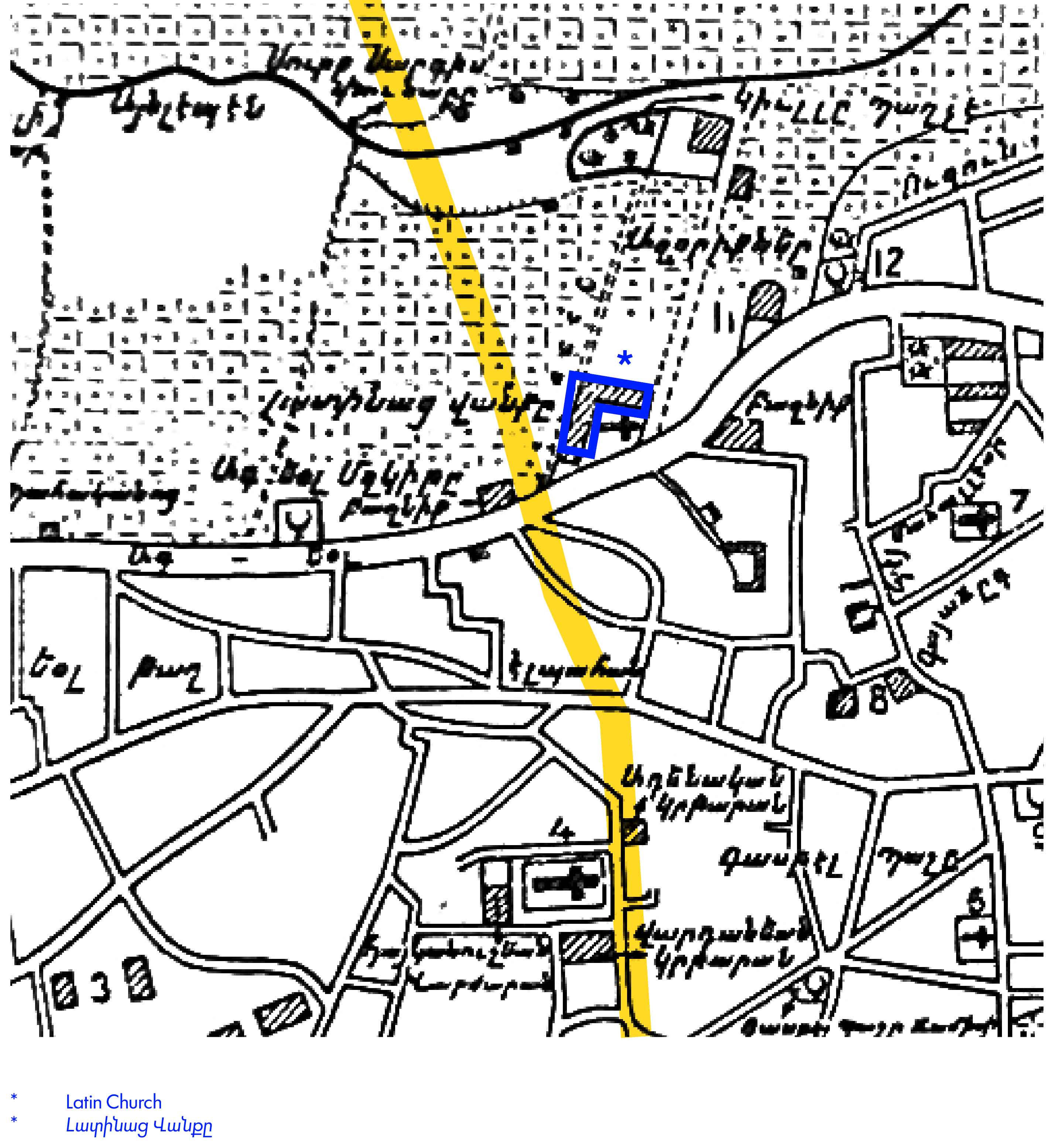
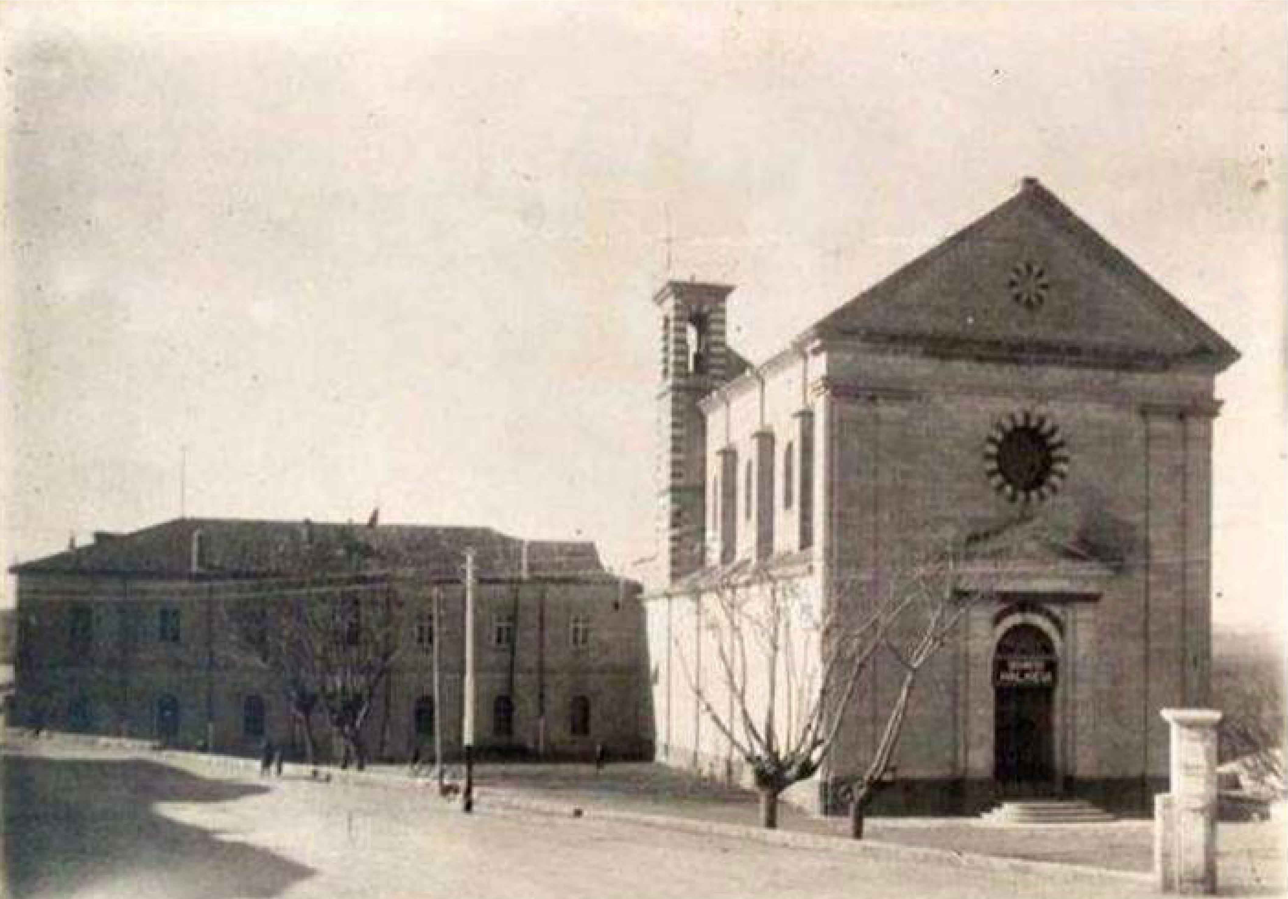
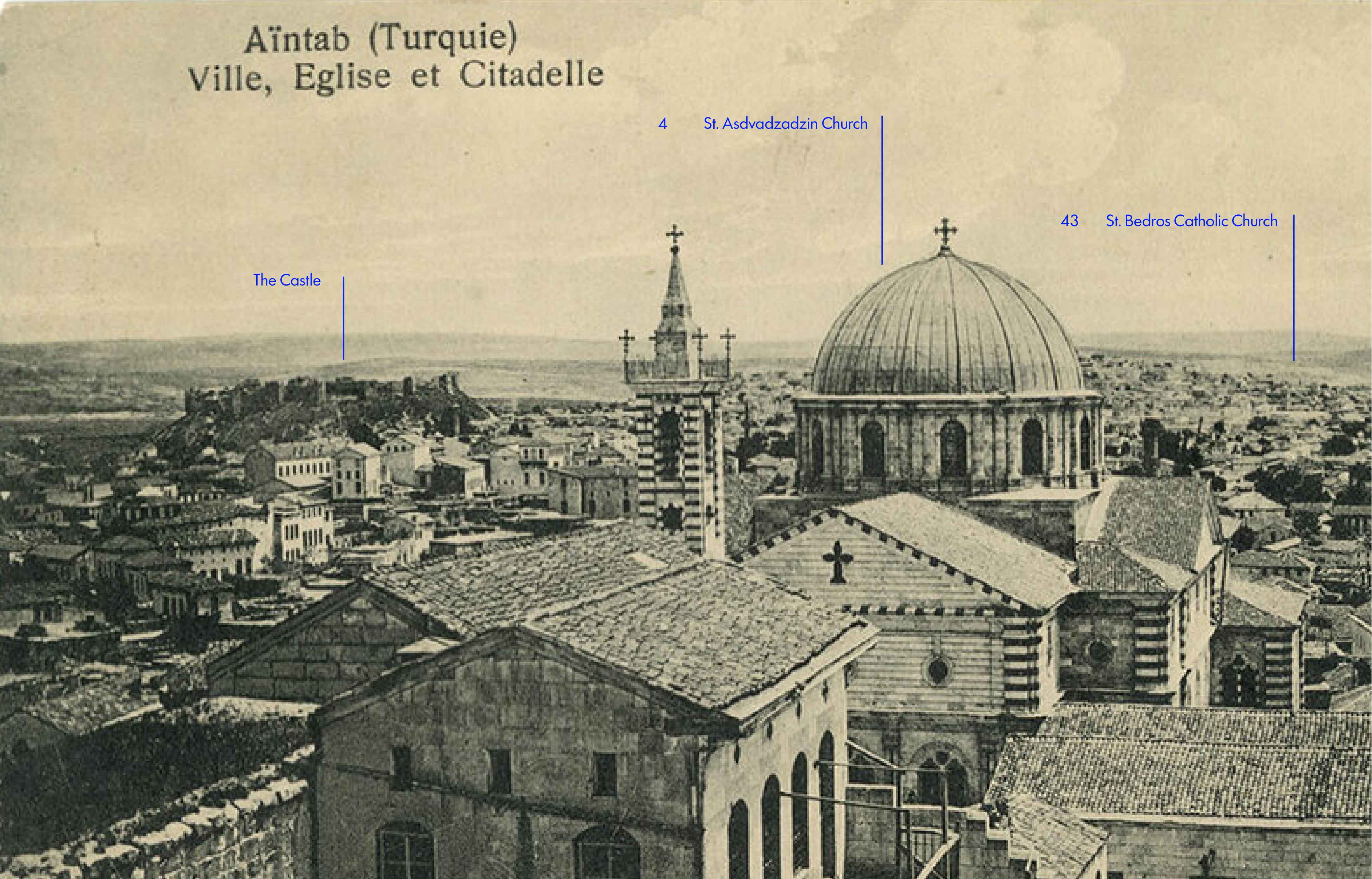
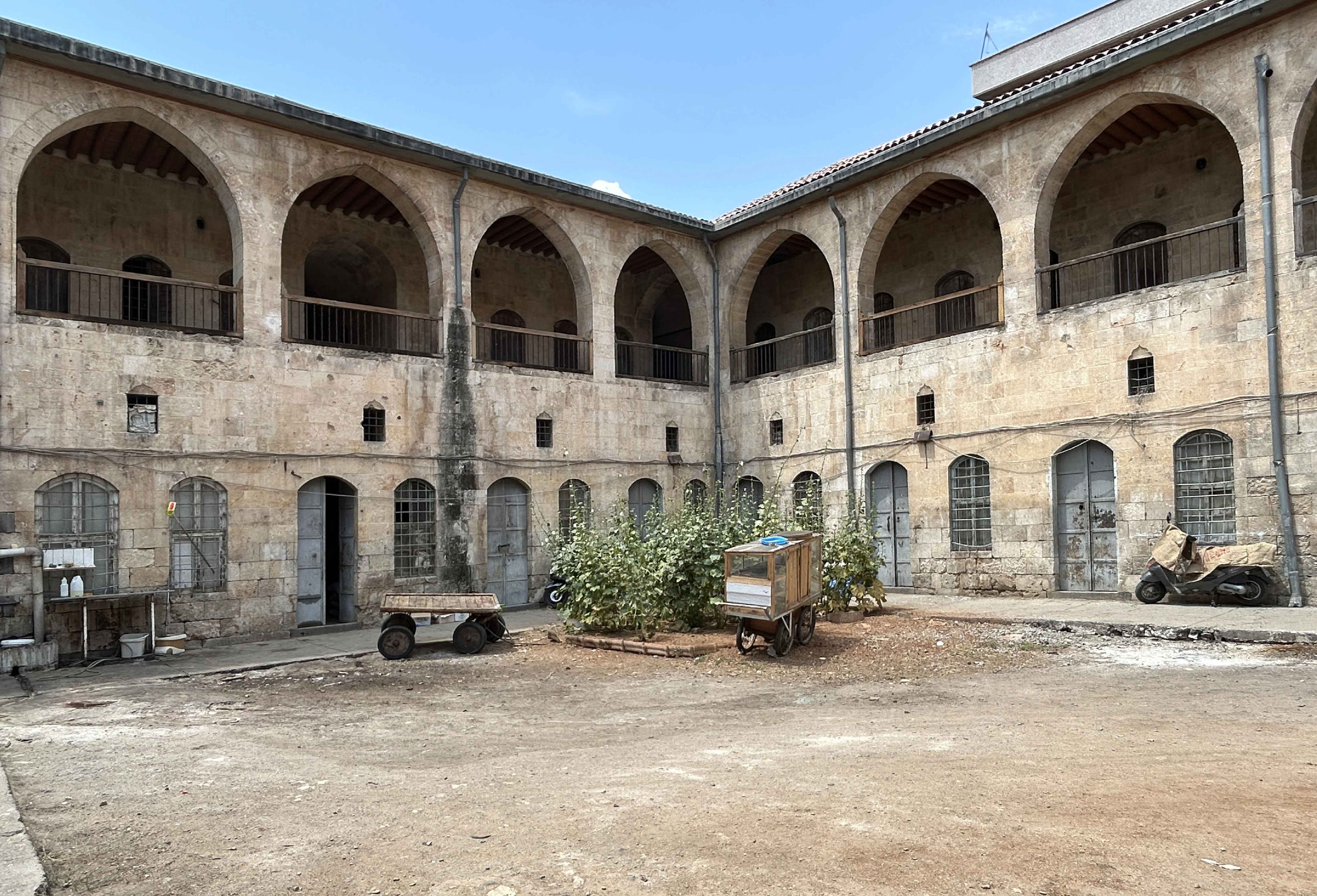
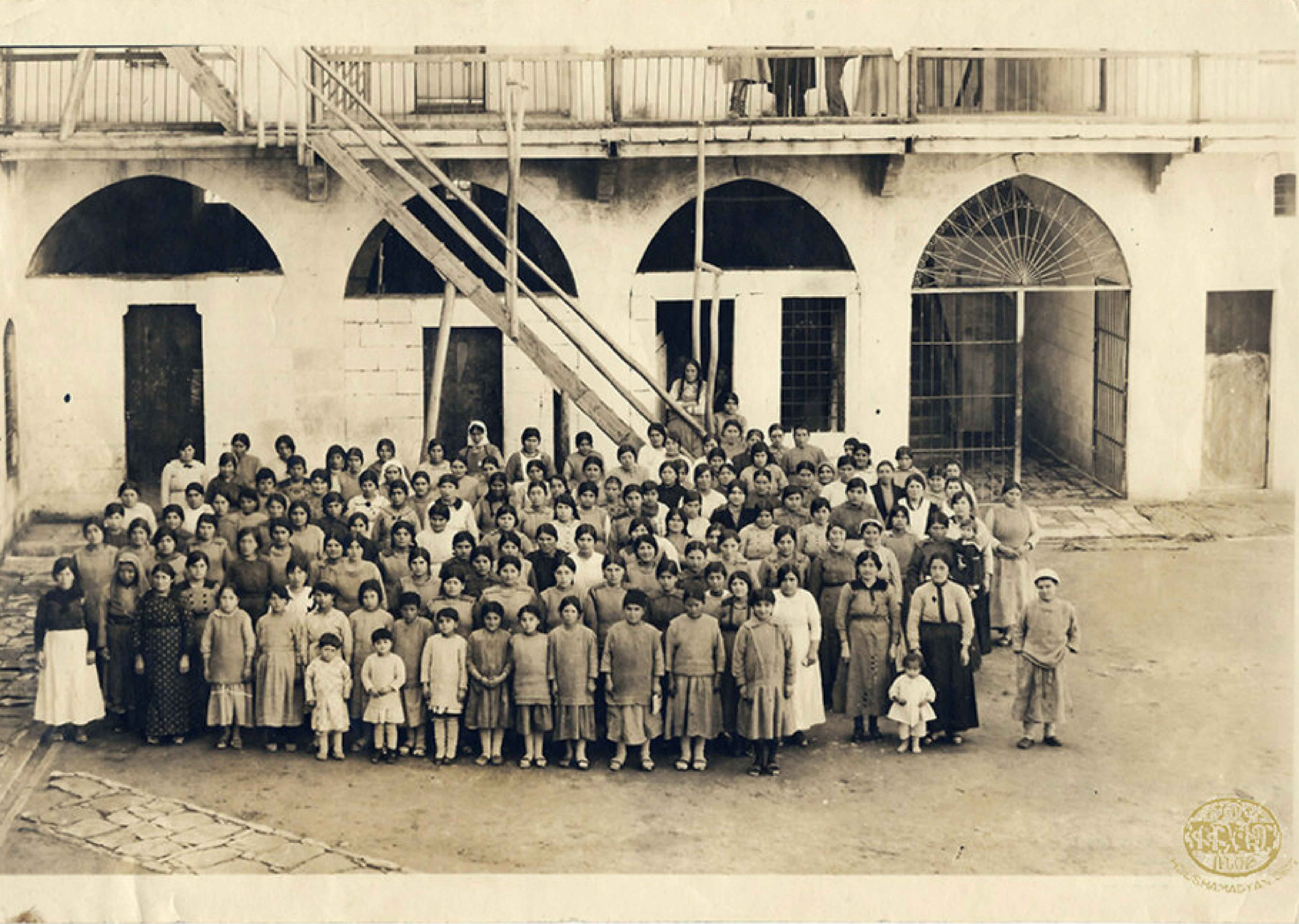
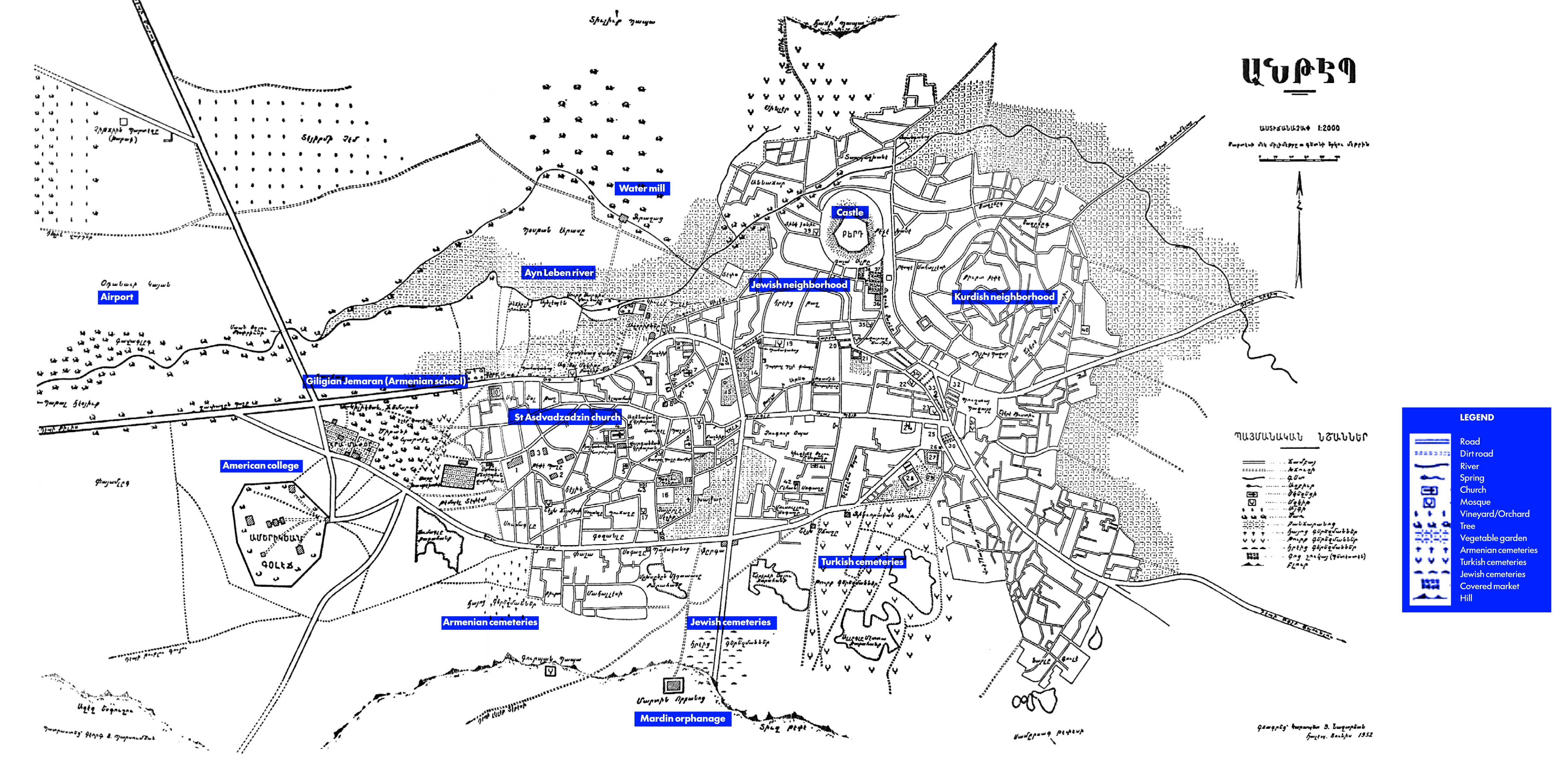
The Latin (Armenian Catholic) Church was a religious and community center located at the northern edge of the Armenian quarter, overlooking the Ayn Leben river and adjacent to Çınarlı Mosque.

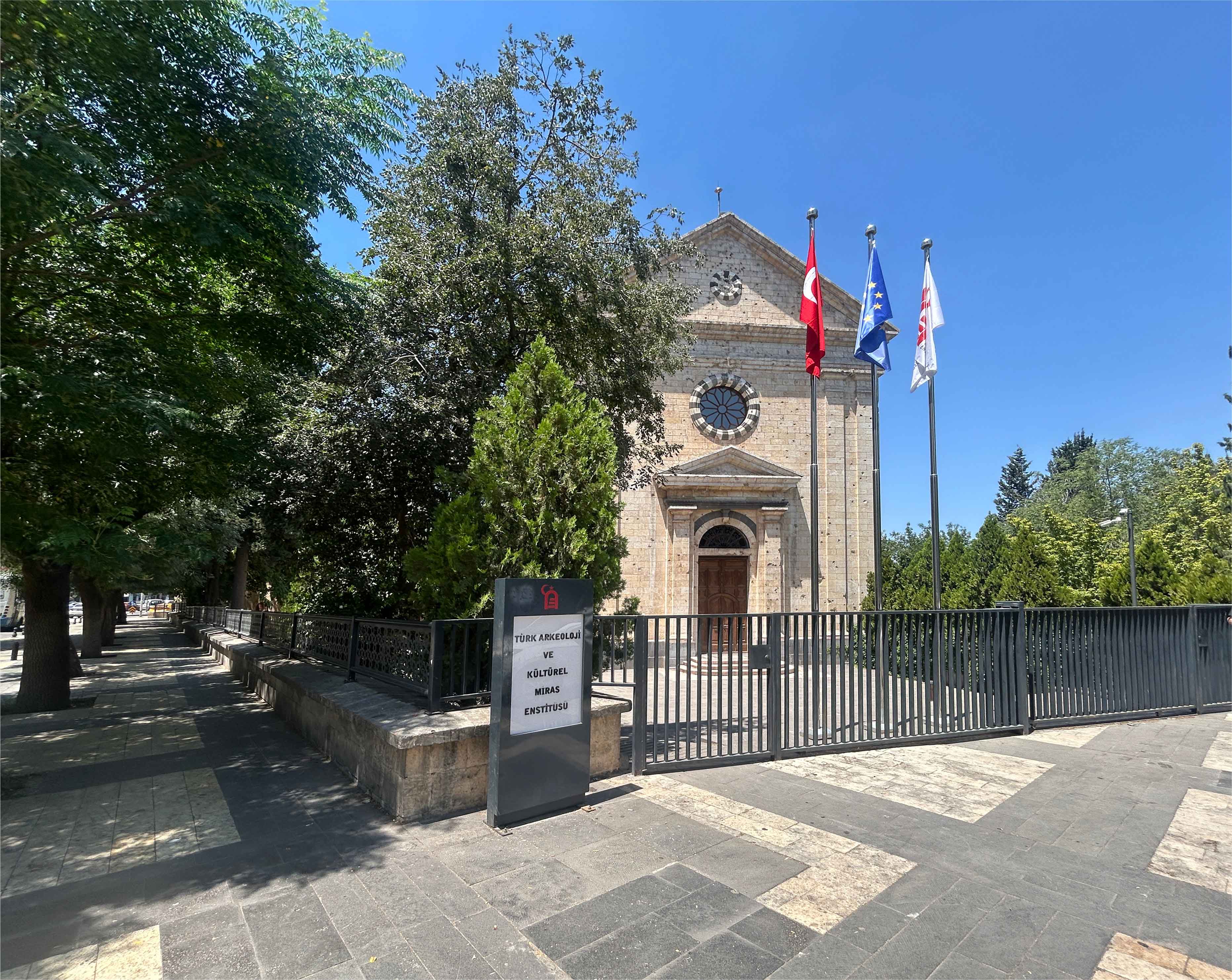
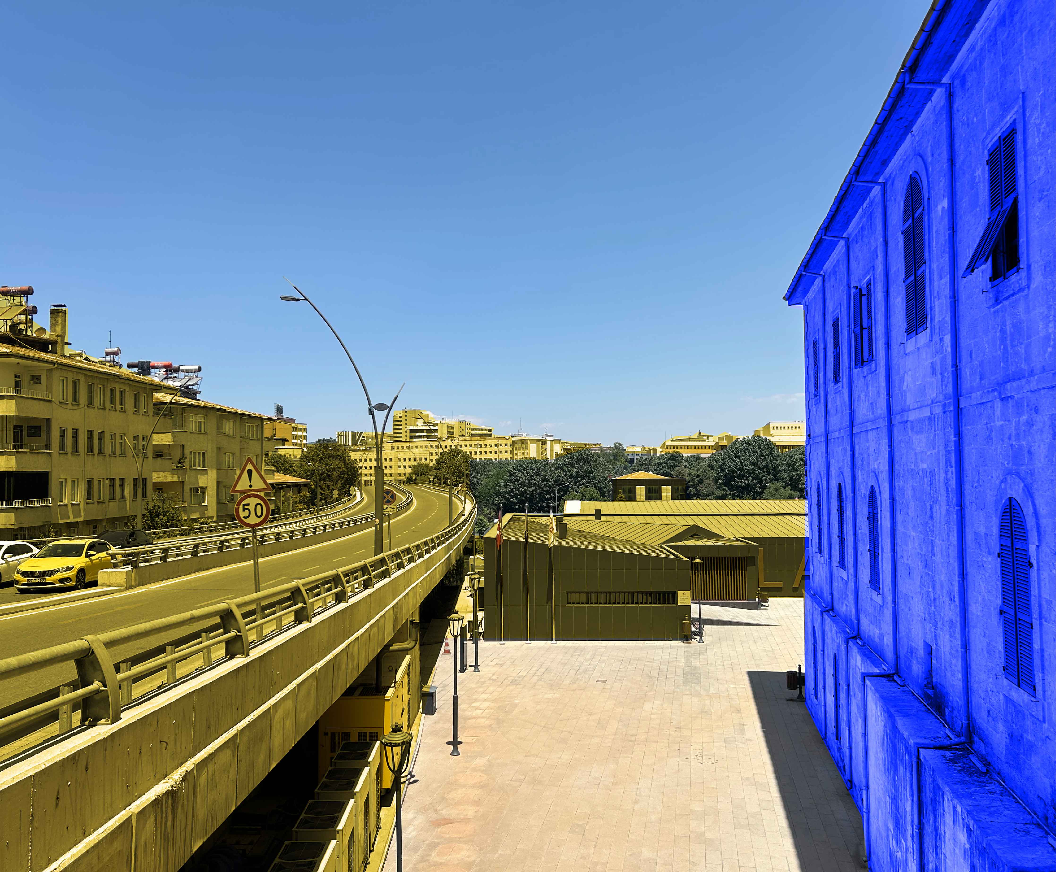
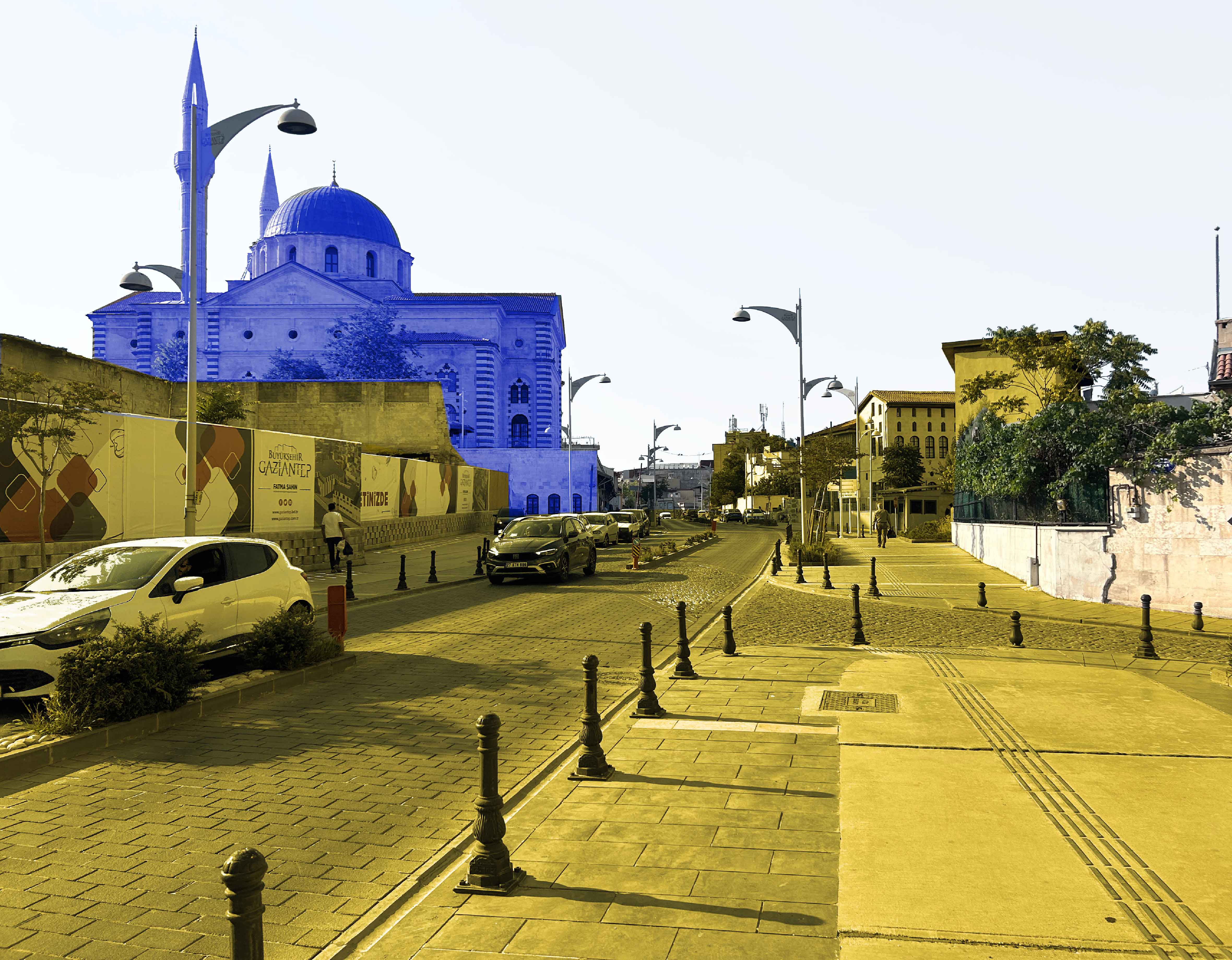
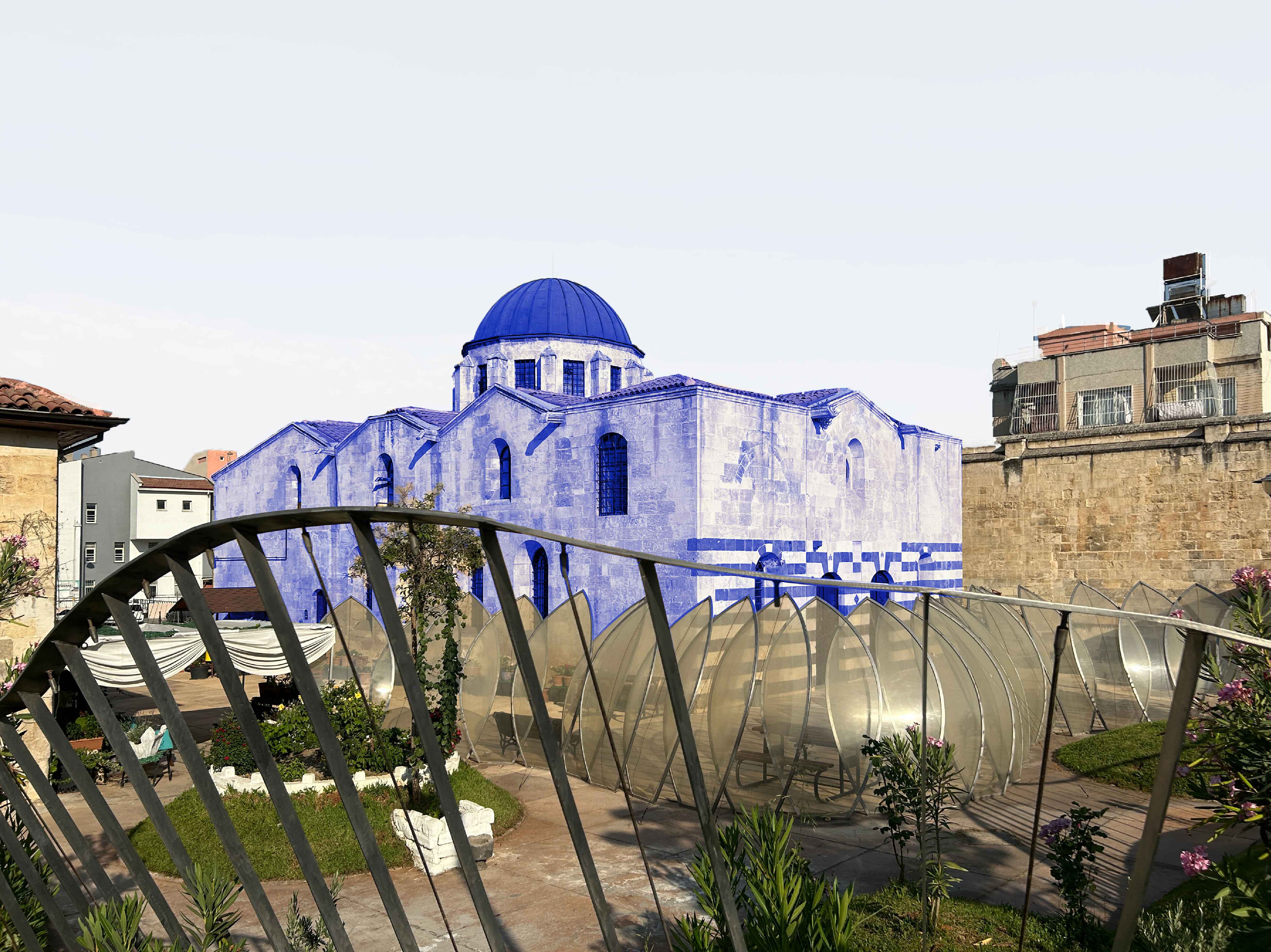
Today, it operates as the Kendirli Gazi Cultural Center, a municipality-owned cultural space slated for conversion into the Anatolian-Turkish Archaeology Institute. Mixed-use development to its west and the construction of Tufan Hamam Road along its southwest edge have altered its relationship to the surrounding urban fabric.

Լատինաց եկեղեցի / Հայ Կաթողիկէ եկեղեցի

Լատինաց (Հայ Կաթողիկէ) եկեղեցին կը գտնուէր հայկական թաղամասին հիւսիսային ծայրին՝ Այն Լեպէն գետին նայող դիրքի վրայ եւ Չընարլը մզկիթին կից։ Ան կը ծառայէր իբրեւ կրօնական եւ համայնքային կեդրոն։

Այսօր շէնքը կը գործածուի իբրեւ Քենտիրլի Կազի Մշակութային Կեդրոն, որը կը պատկանի քաղաքապետարանին եւ նախատեսուած է վերածուելու Անատոլու-Թրքական Հնագիտութեան Հիմնարկի։ Արեւմտեան կողմի կառուցապատումները եւ Թուֆան Համամ ճանապարհի կառուցումը փոխած են անոր կապը շրջակայ քաղաքային հիւսուածքին հետ։

The Latin / Kendirli Church
Now: Kendirli Gazi Cultural Center
Kendirli Gazi Cultural Center Kendirli Gazi Cultural Center
Tufan Hamam Road along the Church’s western edge
St. Asdvadzadzin Church and school cluster

St. Asdvadzadzin was the largest Armenian Apostolic church in Aintab and a major urban landmark, second only to the city castle. A row of shops at its base, operated by Armenian retailers, supported its construction. The church was embedded within a dense urban fabric and surrounded by a cluster of schools.

Converted into a prison in the 1950s, it is now Kurtuluş Mosque, the largest mosque in the city and a symbol of Turkish national victory. The construction of Adil Özbek Street (a continuation of Tufan Hamam Street) in 2005 introduced a major north–south axis that demolished key educational and cultural structures, along with hundreds of Armenian houses, severing the church’s relationship to its surrounding neighborhood.

A few hundred meters to the south, the Armenian Catholic church St. Bedros was confiscated and incorporated into a textile factory and later converted into the Ömer Ersoy Cultural Center. A third Protestant church, located between St. Bedros and St. Asdvadzadzin, was demolished along with the Vartanian School to make way for new development.

Սուրբ Աստուածածին եկեղեցի եւ շրջակայ դպրոցներ

Սուրբ Աստուածածինը Այնթէպի մէջ ամենամեծ Հայ Առաքելական եկեղեցին էր եւ կարեւոր քաղաքային նշան, երկրորդը բերդէն յետոյ։ Անոր հիմքին երկայնքով գտնուող խանութները, որոնք կը պատկանէին հայ վաճառականներու, նպաստած են եկեղեցուոյ կառուցման։ Եկեղեցին խարսխուած էր խիտ քաղաքային հիւսուածքի մէջ եւ շրջապատուած էր շարք մը դպրոցներով։

1950-ականներուն փոխարկուելով բանտի՝ այսօր կը գործածուի իբրեւ Քուրթուլուշ մզկիթ՝ քաղաքին ամենամեծ մզկիթը եւ թրքական ազգային յաղթանակի խորհրդանիշ մը։ 2005-ին կառուցուած Ատիլ Օզբէք փողոցը (Թուֆան Համամ փողոցի շարունակութիւնը)՝ հիւսիս–հարաւ հիմնական առանցք մը, քանդեց կրթական եւ մշակութային կառոյցներ, ինչպէս նաեւ հարիւրաւոր հայկական տուներ՝ խզելով եկեղեցուոյ կապը շրջակայ թաղամասին հետ։

Մի քանի հարիւր մեթր հարաւ՝ Հայ Կաթողիկէ Սուրբ Պետրոս եկեղեցին բռնագրաւուած եւ ներառուած էր տեքստիլի գործարանի մէջ, ապա վերածուած Օմեր Էրսոյ Մշակութային Կեդրոնի։ Երրորդ բողոքական եկեղեցին, որ կը գտնուէր Սուրբ Պետրոսի եւ Սուրբ Աստուածածինի միջեւ, քանդուած է Վարդանեան վարժարանին հետ միասին՝ նոր կառուցապատման յարթակ պատրաստելու համար։

St. Asdvadzadzin Church and school cluster
St. Asdvadzadzin Church
The Holy Mother of God Church (Source: Michel Paboudjian collection, Paris via Houshamadyan.org)
Now: Independence Mosque
St. Bedros Catholic Church
Now: Omer Ersoy Cultural Center
The American Hospital Complex: Tepe Başe (Hilltop)

Constructed in 1882 by American Protestant missionaries, the American Hospital occupied the highest point in the city. It formed part of an institutional cluster with the American Girls College, the Hallajian Orphanage, and the Sahag Mesrobian Armenian School, anchoring the western edge of the city alongside an apricot orchard.

Today, the orphanage and school have been demolished, and the orchard replaced by residential development. The hospital, which has incorporated the Girls College, remains in operation.

Ամերիկեան Հիւանդանոց Համալիրը․ Թէփէ Պաշէ (Բլուրի գագաթ)

1882-ին ամերիկացի բողոքական միսիոնարներու կողմէ կառուցուած Ամերիկեան հիւանդանոցը կը գտնուէր քաղաքին ամենաբարձր կէտին վրայ։ Ան մաս կը կազմէր հաստատութենական համալիրի մը՝ Ամերիկեան Աղջկանց Քոլէճի, Հալլաճեան որբանոցի եւ Սահակ Մեսրոպեան հայկական վարժարանի հետ, սահմանելով քաղաքին արեւմտեան եզրը կից ծիրանի այգիին։

Այսօր որբանոցն ու վարժարանը քանդուած են, իսկ այգին տեղ կառուցուած է բնակելի շէնքեր։ Հիւանդանոցը, որ ներառած է Քոլէճի շէնքը, տակաւին կը գործէ։

The American Hospital Complex: Tepe Başe (Hilltop)
Site of Mesrobian School
Site of Hallajian Orphanage
Armenian cemeteries

Armenian, Jewish, and Turkish cemeteries once lined the southern edge of the city. All three have been built over in the course of urban expansion; only the Turkish cemetery was relocated to the north. The site of the Armenian cemetery is now a deteriorating residential area.

Հայկական գերեզմանատուներ

Հայկական, հրեական եւ թրքական գերեզմանատուները կը գտնուէին քաղաքին հարաւային եզրին։ Երեքն ալ կառուցապատուած են քաղաքային ընդարձակման ընթացքին, սակայն միայն թրքական գերեզմանատունը տեղափոխուած է հիւսիս, միւս երկուքը ամբողջովին քանդուած։ Հայկական գերեզմանատան վայրը այսօր վատ վիճակի մէջ գտնուող բնակելի տարածք մըն է։

Hand-drawn map showing armenian cemeteries
Site of the Armenian Cemetery
Armenian cemeteries
Mansions of Prominent Armenian Families

Mansions belonging to notable Armenian business and community leaders formed part of the residential core of the most highly concentrated Armenian neighborhood. This area has been rebranded as a heritage tourism district, with former mansions repurposed as hotels, restaurants, gift shops, and museums. These included Kara Nazar Nazaretian’s mansion (now a café), Dr. Avedis Jebejian’s mansion (now the Gaziantep Atatürk Anı Müzesi), and Nigoghos Agha Nazaretian’s mansion (now demolished).

Նշանաւոր Հայ Ընտանիքներու Տուներ

Նշանաւոր հայ վաճառականներու եւ համայնքային առաջնորդներու տուները մաս կը կազմէին թաղամասին բնակելի յատուածին: Անոնց մէջ էին Քարա Նազար Նազարեթեանի տունը (այժմ սրճարան), Տոքթ. Աւետիս Ճէպէճեանի տունը (այժմ Կազիանթեփ Աթաթիւրք թանգարան) եւ Նիկողոս Աղա Նազարեթեանի տունը (քանդուած)։

Այս տարածքը, որ ժամանակին ամենախիտ հայկական բնակեցումն էր, վերադասուած է իբրեւ ժառանգութեան զբօսաշրջային գօտի՝ նախկին հայկական կալուածները վերածելով հիւրանոցներու, ճաշարաններու, նուէրներու խանութներու եւ թանգարաններու։

Hand-drawn mapping showing mansions of prominent Armenian families
Kara Nazar Nazaretian Mansion
Now: Tourist Cafe
Kara Nazar Nazaretian Mansion, now a tourist cafe Kara Nazar Nazaretian Mansion, now a tourist cafe
Name plate at the entrance of the Nazaretian Mansion, the logotype seal says “Nazar” in Armenian.
Dr. Avedis Jebejian Mansion
Now: Gaziantep Atatürk Anı Müzesi
Dr. Avedis Jebejian Mansion, now Gaziantep Atatürk Anı Müzesi Dr. Avedis Jebejian Mansion, now Gaziantep Atatürk Anı Müzesi
Site of Nigoghos Agha Nazaretian Mansion
Now: Tarihi Cinarli Kahvesi Coffeeshop
Site of Nigoghos Agha Nazaretian Mansion, Now: Tarihi Cinarli Kahvesi Coffeeshop
Commercial Street of Inns

Aintab was a major center of commerce, agriculture, and craftsmanship, second only to Aleppo in regional prosperity. Key goods included cotton, tobacco, pistachios, raisins, wool, arak, and olive oil. Production and trade were organized through 31 hans, which also functioned as inns for traveling merchants.

Many were located along present-day Hamdi Kutlar and Şehitler streets, including Millet Han—built by the Armenian Church to support the community—and Kurkchuian Han, operated by the Kurkchuian family.

Today, Millet Han functions as a tourist café and gift shop, while Kurkchuian Han remains inactive within a dense bazaar. Although these structures still stand, their original economic role has largely disappeared.

Առեւտրական Խաներու Փողոցը

Այնթէպը կարեւոր առեւտրական, գիւղատնտեսական եւ արհեստագործական կեդրոն մըն էր՝ շրջանին մէջ երկրորդը Հալէպէն յետոյ։ Գլխաւոր ապրանքներն էին բամբակ, ծխախոտ, պիստակ, չամիչ, բուրդ, ինչպէս նաեւ օղիի եւ ձիթապտուղի արտադրութիւն։ Արտադրութիւնը եւ առեւտուրը կազմակերպուած էին 31 խաներու միջոցով, որոնք նաեւ կացարան կը ծառայէին ճամբորդ վաճառականներուն։

Շատ խաներ կը գտնուէին այսօրուան Համտի Քութլար եւ Շեհիթլեր փողոցներուն երկայնքով, ներառեալ Միլլէթ Խանը՝ կառուցուած Հայ Եկեղեցուոյ կողմէ համայնքին աջակցելու համար, եւ Քիւրքչիւեան Խանը՝ գործածուած Քիւրքչիւեան ընտանիքին կողմէ։

Այսօր Միլլէթ Խանը կը գործէ իբրեւ զբօսաշրջային սրճարան եւ նուէրներու խանութ, մինչ Քիւրքչիւեան Խանը կը մնայ լքուած՝ խիտ շուկայի մը մէջ։ Թէեւ այս կառոյցները տակաւին կը կանգնին, անոնց նախնական տնտեսական գործառոյթը մեծապէս կորսուած է։

Hand-drawn map showing commercial street of inns
Kurkchuian Inn (Han)
Kurkchuian Inn (Han) nameplate
Name plate at the entrance of the Kurkchuian Inn, reading Kurkchuian 1890/1307, in both Armenian and Arabic-Ottoman scripts.
Now: Inactive Warehouse
Millet Inn (Han)
Millet Inn (Han)
The orphans and staff of the Near East Relief orphanage, photographed at the time when the orphanage was housed inside Millet Khan. Photo via Houshamadyan.org
Now: Touristic site / Cafe
All photos are courtesy of An Armenian Atlas, except noted otherwise.