ARMENIAN
ATLAS Աշխարհացոյց
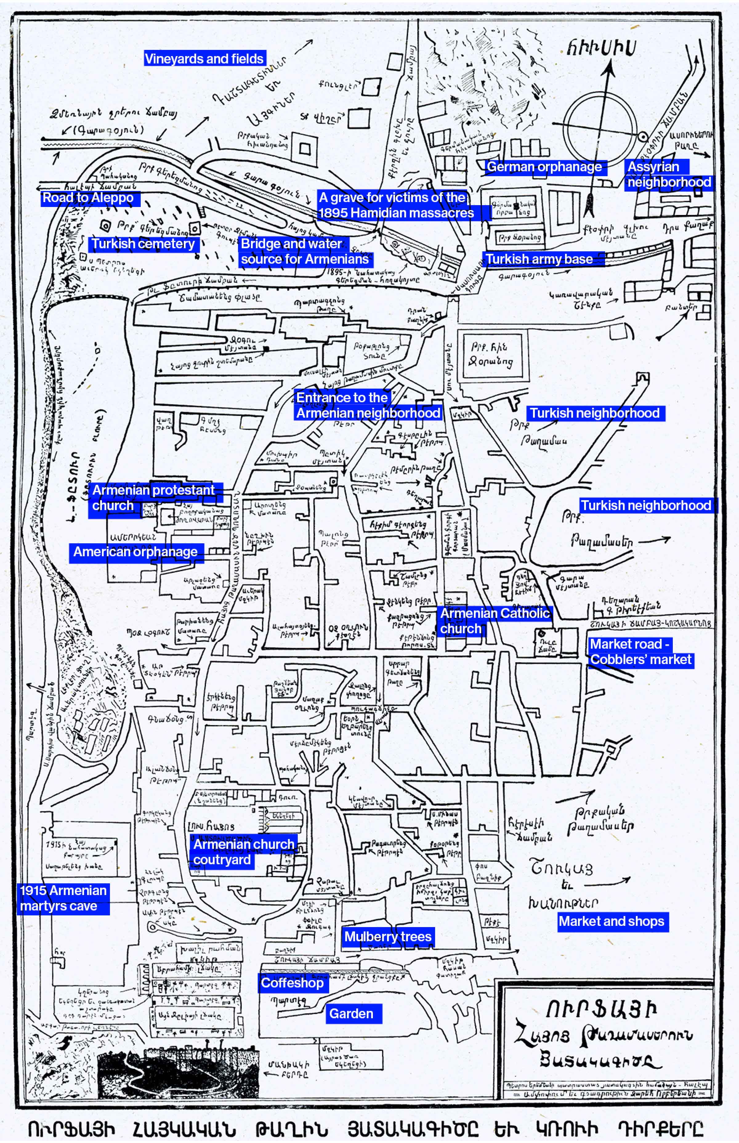
Map of Urfa by Zareh Vorperian / Bedros Yeremian • Source: Aram Sahagian, Mythical Urfa and Her Offspring [in Armenian], published by the Union of Ourfa Armenians, Beirut, 1955
Ուրֆայի քարտէսը՝ Զարեհ Որբերեան / Պետրոս Երեմեան • Աղբիւր՝ Արամ Սահակեան, Առասպելական Ուրֆա եւ իր զաւակները, Հայրենակցական Միութիւն Ուրֆացիներու, Պէյրութ, 1955
Urfa—historically known as Edessa—was a multi-ethnic city in Upper Mesopotamia and an important cultural and economic center linking Anatolia to the Syrian plains. Armenians formed a substantial and vibrant community, numbering between 25,000 and 30,000 and making up nearly one-third of the city's population on the eve of the First World War alongside other minorities including Assyrian and Latin Christian communities.
The Armenian quarter, rising along the slopes of Mt. Telfedur, was structured around a dense network of social and economic instiutions anchored by the Cathedral of the Holy Mother of God, as well as schools, workshops, and bazaars. Armenians played a central role in the city’s commercial and craft production, dominating trade and participating in guilds such as stonecutting, weaving, metalwork, and dyeing. This activity was supported by the fertile agricultural landscape irrigated by the Berik River.
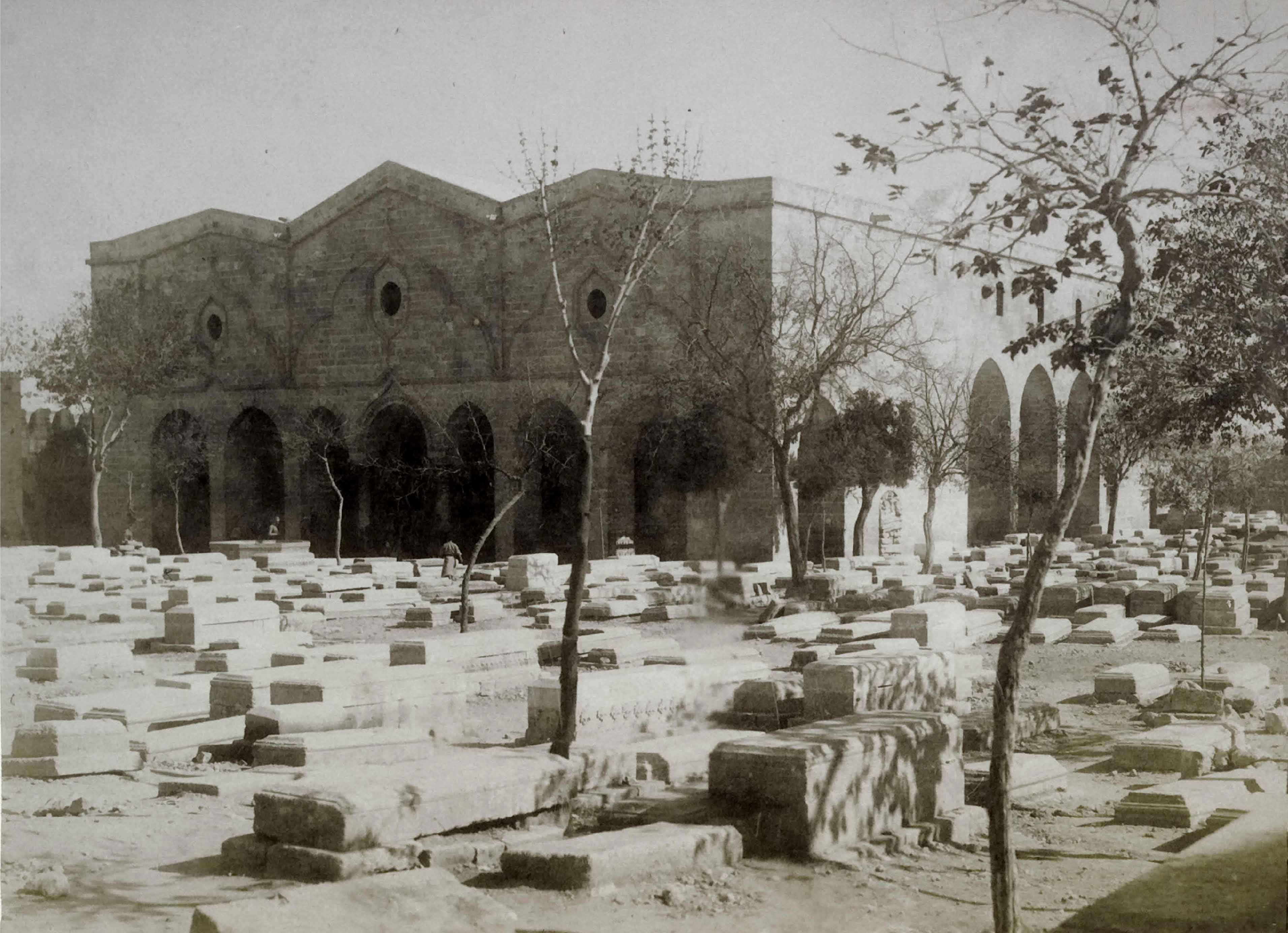
This urban and social fabric was violently disrupted at the end of the 19th and beginning of the 20th centuries: the Hamidian massacres of 1895—during which the cathedral was burnt and and thousands of Armenians were killed—and the 1915 Urfa resistance, a three-week defense mounted by Armenians against deportation, which was ultimately crushed by Ottoman troops. In the aftermath of the genocide, the surviving population was displaced, and the material and institutional presence of Armenians and other Christian communitieswas systematically erased or appropriated and repurposed. What remains is a city whose former diversity persists largely through archival traces and acts of memory.
Ուրֆա՝ պատմականօրէն Եդեսիա անունով ծանօթ, բազմազգ քաղաք մըն էր Վերին Միջագետքի մէջ եւ կարեւոր մշակութային ու տնտեսական կեդրոն մը, որ կը կապէր Անատոլիան Սուրիական դաշտերուն։ Հայերը կը կազմէին նշանակալի եւ կենսունակ համայնք մը՝ Առաջին Համաշխարհային պատերազմին նախօրէին 25,000–30,000 բնակչութեամբ՝ քաղաքի բնակչութեան մօտ մէկ երրորդը, ասորիներու եւ լատին քրիստոնեաներու կողքին։
Հայկական թաղամասը, որ կը բարձրանար Թելֆետուր լերան լանջերուն վրայ, կը կազմակերպուէր խիտ հաստատութենական եւ տնտեսական կեանքի շուրջ, որ կեդրոնացած էր Սուրբ Աստուածածին մայր եկեղեցուոյ շուրջ, ինչպէս նաեւ դպրոցներու, արհեստանոցներու եւ շուկաներու։ Հայերը առանցքային դեր ունէին քաղաքի առեւտրական եւ արհեստագործական արտադրութեան մէջ՝ գերիշխելով առեւտուրը եւ մասնակցելով արհեստակցական միութիւններու, ինչպէս քարակերտութիւնը, հիւսուածքը, մետաղագործութիւնը եւ ներկարարութիւնը։ Այս գործունէութիւնը կը սնուցուէր Բերիկ գետի ոռոգած բերրի երկրագործական միջավայրով։
Այս քաղաքային եւ ընկերային հիւսուածքը բռնարարաբար խախտուեցաւ 19-րդ դարու վերջաւորութեան եւ 20-րդ դարու սկիզբին՝ 1895-ի Համիտեան ջարդերով, որոնց ընթացքին այրուեցաւ մայր եկեղեցին եւ հազարաւոր հայեր սպաննուեցան, եւ 1915-ի Ուրֆայի դիմադրութեամբ՝ երեքշաբաթեայ պաշտպանութիւն մը տեղահանութեան դէմ, որ ի վերջոյ ճնշուեցաւ օսմանեան զօրքերու կողմէ։ Ցեղասպանութենէն ետք ողջ մնացած բնակչութիւնը տեղահանուեցաւ, եւ հայերու, ինչպէս նաեւ այլ քրիստոնեայ համայնքներու, նիւթական եւ հաստատութենական ներկայութիւնը համակարգուած կերպով ջնջուեցաւ կամ վերափոխուեցաւ։ Այսօր կը մնայ քաղաք մը, ուր նախկին բազմազանութիւնը կը գոյատեւէ գլխաւորաբար արխիւային հետքերու եւ երբրեմն յիշողութեան միջոցներով։
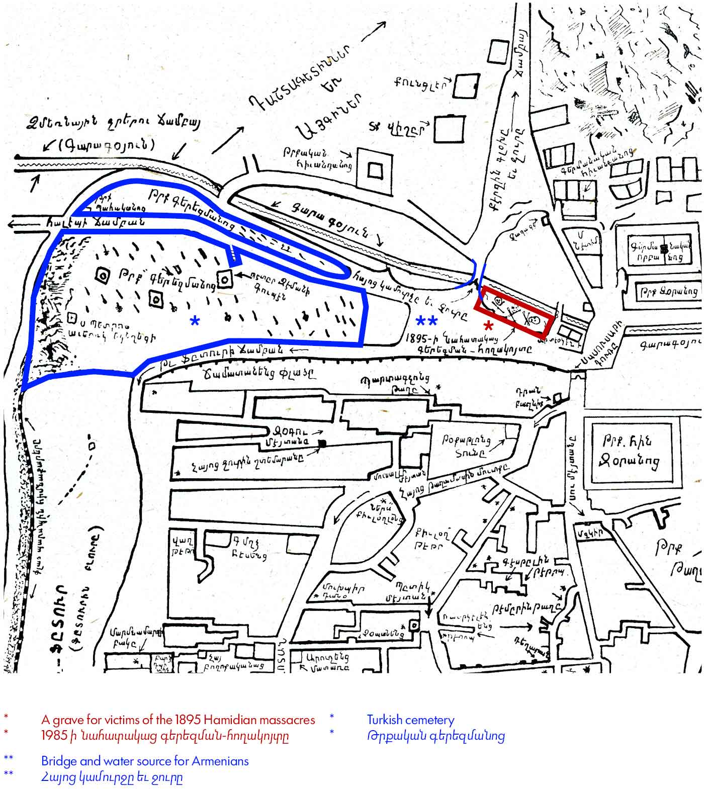
The northern edge of the neighborhood was marked by the Karakoyun River, crossed by bridges that connected the urban fabric to surrounding fields and orchards.
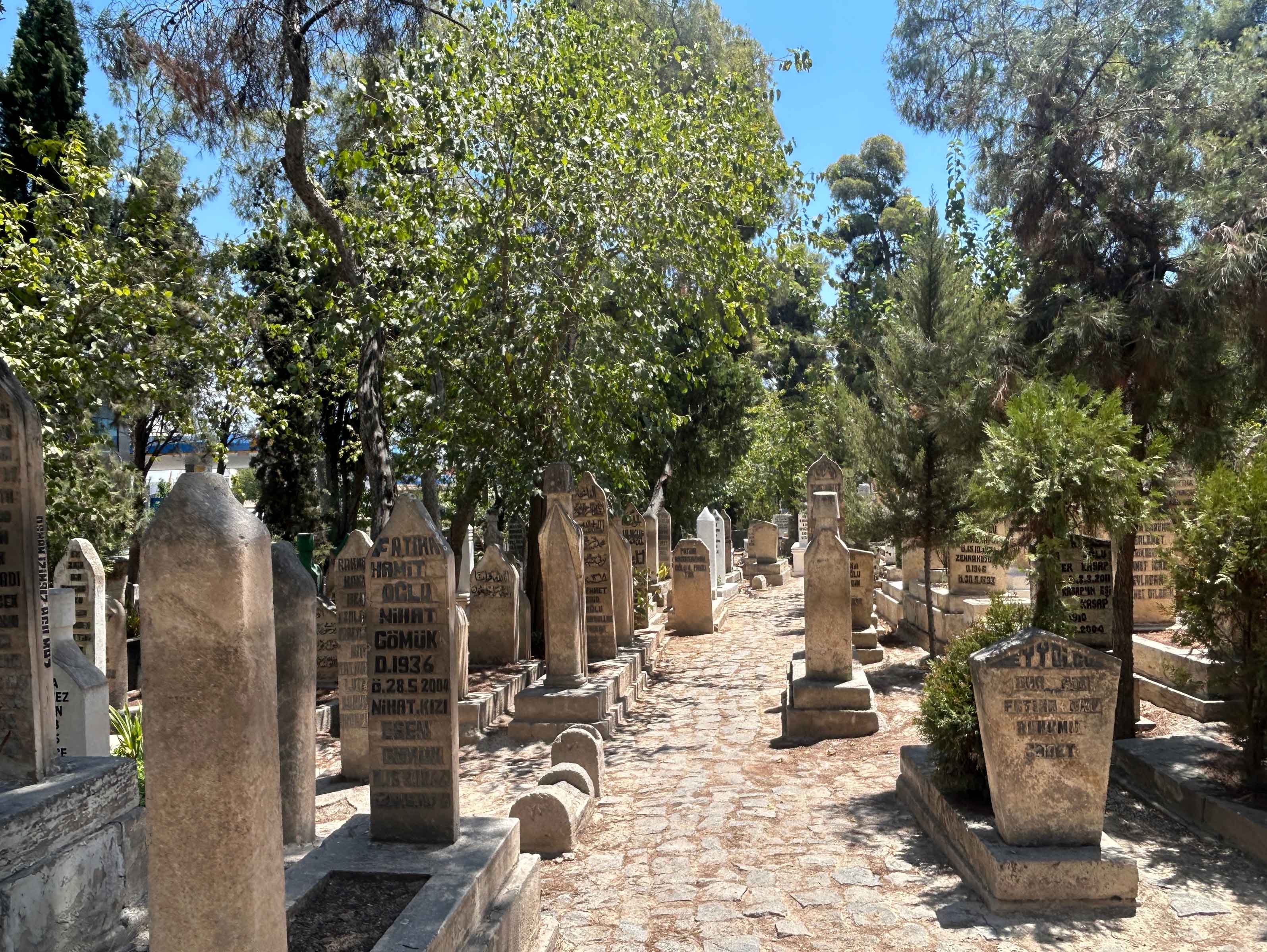
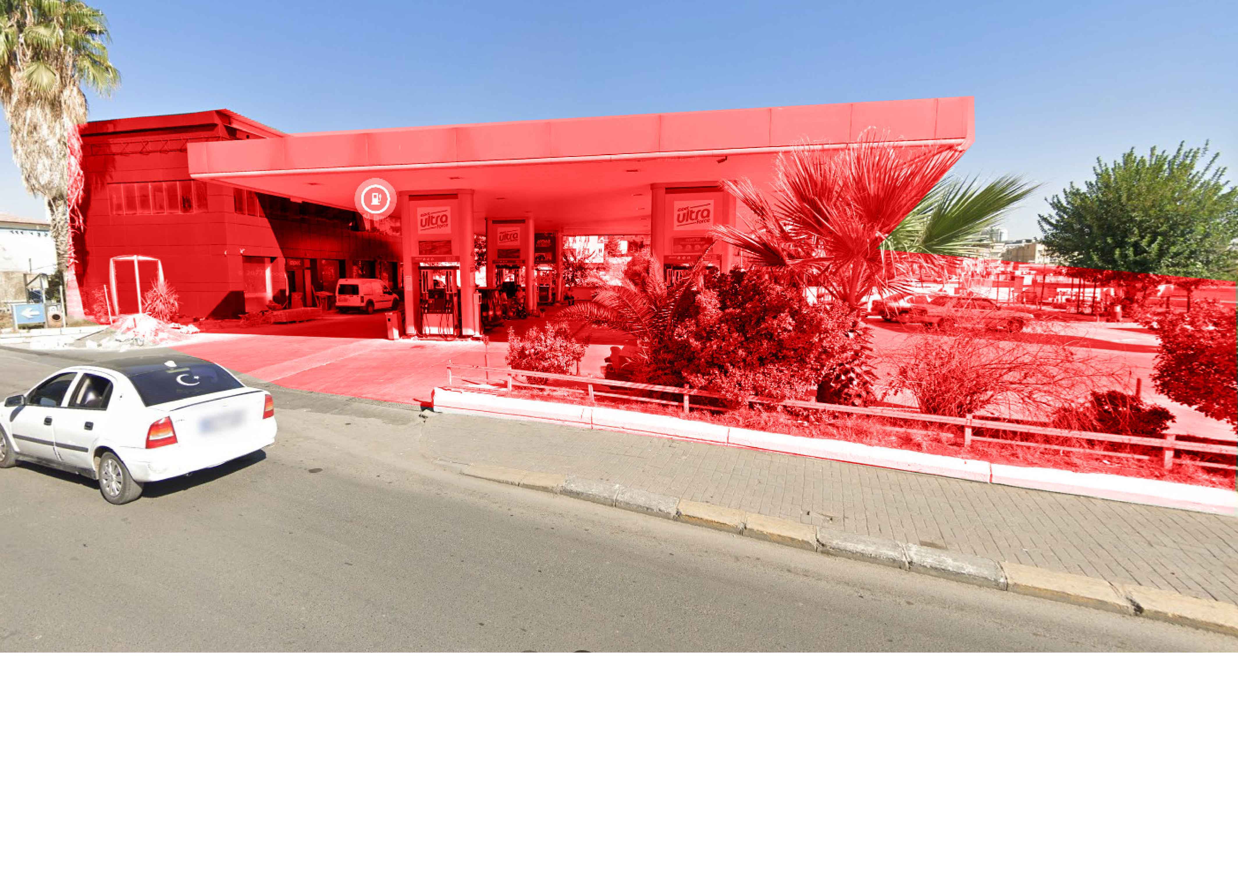
The mental map depicts the Turkish cemetery on the western side and the grave for victims of the 1895 Hamidian massacres on the eastern side, along the river and adjacent to a bridge used by Armenians to cross to the opposite bank and access water and agricultural lands. Today, the Turkish cemetery still stands, while the Armenian burial site has been destroyed and replaced by a gas station. The bridge remains, connecting the old city to newer developments to the north.
Թաղամասին հիւսիսային սահմանը կը նշուէր Քարակոյուն գետով, որուն վրայ կամուրջներ կը կապէին քաղաքը շրջակայ դաշտերուն եւ այգիներուն։
Քարտէսը կը նշէ թրքական գերեզմանատունը արեւմտեան կողմը եւ 1895-ի Համիտեան ջարդերու զոհերու գերեզմանը արեւելեան կողմը՝ գետին երկայնքով եւ այն կամուրջին մօտ, որով հայերը կ՚անցնէին գետը՝ ջուրի եւ դաշտերու հասնելու համար։ Այսօր թրքական գերեզմանատունը կը շարունակէ գոյութիւն ունենալ, մինչ հայոց գերեզմանատունը քանդուած է եւ անոր վրայ կառուցուած է կազի կայան։ Կամուրջը տակաւին կանգուն է՝ միացնելով հին քաղաքը հիւսիսային նոր քաղաքային զարգացումներուն։
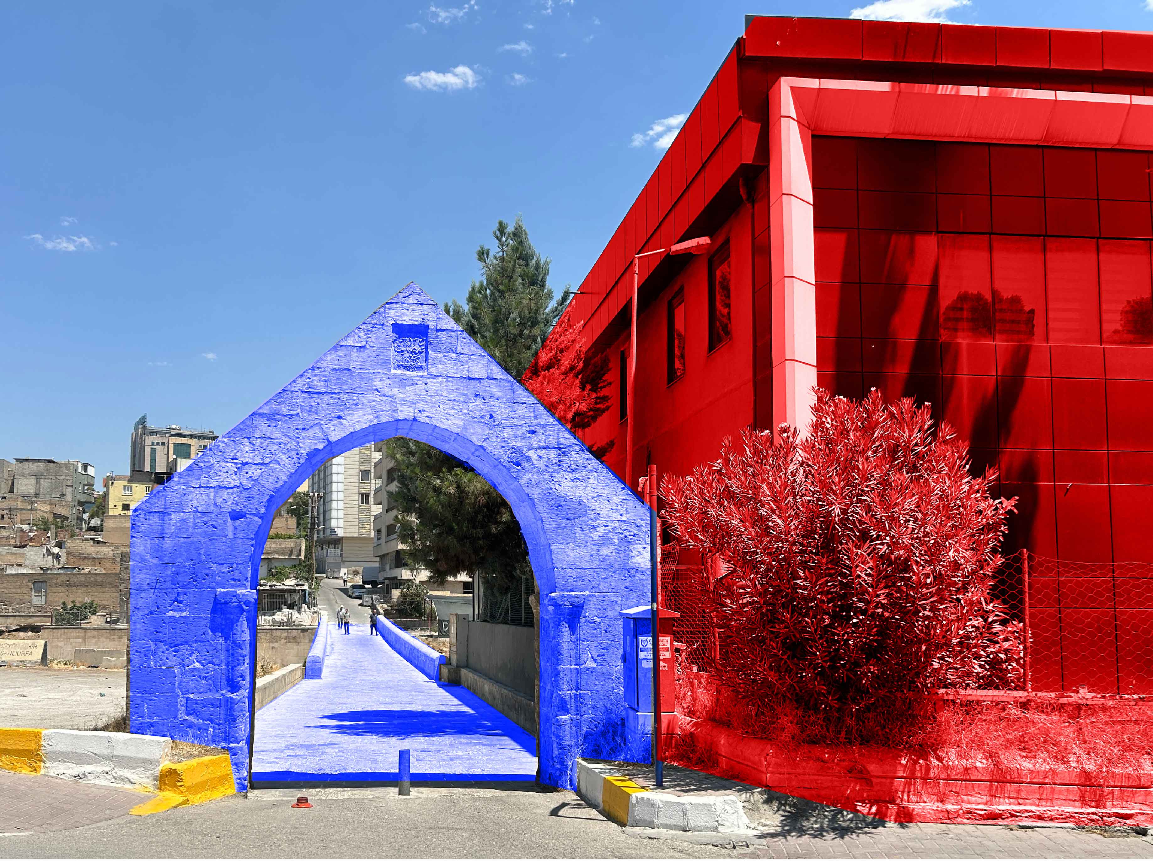
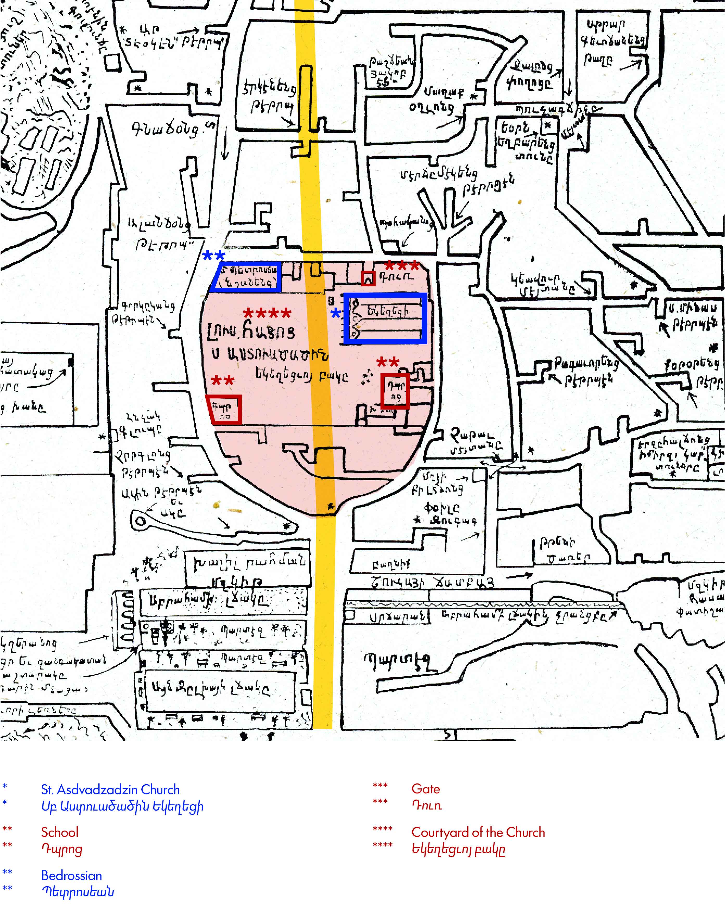
St. Asdvadzadzin Church was a major center of communal life and the southern anchor of the old city and Armenian neighborhood, located just above Abraham’s Pool and the cafés and leisure spaces along the southern edge of the city.
The church formed part of a larger educational and religious complex organized around a spacious central courtyard. A new road, Vali Fuat Caddesi, was later constructed through the courtyard, resulting in the destruction of the Armenian cemetery located there, along with several educational buildings belonging to the complex. The church itself was subsequently converted into the Selahaddin Eyyubi Mosque.
Սուրբ Աստուածածին եկեղեցին համայնքային կեանքի կեդրոն մըն էր, կազմելով քաղաքի եւ հայկական թաղամասի հարաւային առանցքը, Աբրահամի լճակին եւ քաղաքի հարաւային եզրին գտնուող սրճարաններուն ու հանգստեան վայրերուն հիւսիսը:
Եկեղեցին մաս կը կազմէր կրթական եւ կրօնական համալիրի մը, որ կազմակերպուած էր ընդարձակ կեդրոնական բակի շուրջ։ Հետագային Վալի Ֆուատ Ճատտեսի անունով նոր ճամբայ մը կը կառուցուի բակին միջով, որուն արդիւնք այնտեղ գտնուող հայկական գերեզմանատունը եւ համալիրին պատկանող կրթական շէնքերը կը քանդուին: Իսկ եկեղեցին՝ ան կը վերածուածուի Սելահատին Էյուպի մզկիթի։